


 Language

Best places to hike in Colorado: 2026 guide
Where to hike in Colorado, from Rocky Mountain National Park's alpine trails to Garden of the Gods' easy walks, with picks for every season and skill level.

Where to hike in Colorado depends on two things: where you’re based and when you’re going. Lower trails near Denver can be hikeable in spring, while high alpine routes often hold snow into early summer. This guide covers the best places to hike in Colorado by region. It also shares the best time to hike per season and tips on altitude, storm timing, and trailhead permits to plan more realistically.
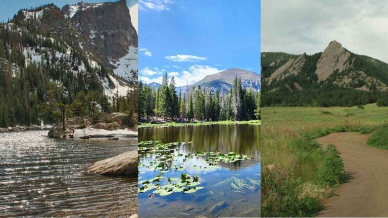
Quick picks: the best places to hike in Colorado
Want a snapshot? The 10 best hikes in Colorado, by region, difficulty, and best season:
| Trail | Region | Difficulty | Best season |
|---|---|---|---|
| Maxwell Falls | Evergreen, near Denver | Easy | Spring |
| Garden of the Gods | Colorado Springs | Easy | September–October |
| Maroon Lake | Maroon Bells, near Aspen | Easy | June–September |
| Emerald Lake | Rocky Mountain National Park | Moderate | June–September |
| Royal Arch | Boulder | Moderate to hard | October |
| Mount Sanitas | Boulder | Hard | October |
| Sky Pond | Rocky Mountain National Park | Hard | Late summer–September |
| Mount Bierstadt | Guanella Pass, near Denver | Hard (fourteener) | After mid-June |
| Quandary Peak | South of Breckenridge | Hard (fourteener) | Summer |
| Manitou Incline | Manitou Springs, near Colorado Springs | Extreme | September–October |
Best hikes near Denver
Some of the best hikes near Denver sit around Morrison and Evergreen, plus a fourteener near Georgetown. For a short walk on arrival day, there are also hiking trails near Denver’s airport.
Mount Falcon Park
Mount Falcon Park in Morrison offers day hikes near Denver. You’ll pass John Brisben Walker’s castle and the cornerstone of a would-be summer White House for US presidents.
- Distance and difficulty: The 3.9-mile Castle Trail rises from about 6,000 to 7,800 feet, a steep, vigorous climb from the east.
- Best season: September and October, when nearby Evergreen averages highs of 61°F to 73°F and less precipitation than in spring or summer.
- Practical tip: The 1.7-mile Turkey Trot Trail is reserved for hikers and horseback riders, while the park’s other trails are multi-use.
Maxwell Falls
Maxwell Falls, in Arapaho National Forest, is our pick of the best hikes near Denver with water. The trail follows Maxwell Creek, making it an option among waterfall hikes near Denver.
- Distance and difficulty: The 2.3-mile trail runs between the upper and lower trailheads, and it’s one of the easiest trails in the Clear Creek Ranger District.
- Best season: Spring, when the falls are at their best with plentiful snow runoff.
- Practical tip: Being in the area after sundown or before sunrise is prohibited, so plan a daytime hike.
Mount Bierstadt
For the best mountain hikes near Denver, our pick is Mount Bierstadt, starting at Guanella Pass. The trail crosses willow wetlands on a boardwalk toward Scott Gomer Creek, and then climbs to the peak’s west ridge, growing steeper.
- Distance and difficulty: The trail is 3.6 miles one way, rising from 11,471 to 14,063 feet.
- Best season: After June 15, when the annual mud-season closure ends, though the area is not generally snow-free until late June or early July.
- Practical tip: Park only in the designated upper and lower lots, since roadside parking is not allowed.
Trading Post Trail
This manageable hike for groups or families runs through Red Rocks Park, a Denver Mountain Park, and a natural meadow. Children still need supervision, since parts of the trail have drop-offs, steep grades, and road crossings.
- Distance and difficulty: The trail is 1.4 miles at about 6,280 feet, with some rough terrain, so hiking boots or shoes are recommended.
- Best season: September and October, when nearby Lakewood averages highs of 63°F to 76°F and less precipitation than April through August.
- Practical tip: Red Rocks closes at about 2 p.m. on event days, so check the concert calendar first.
Best hikes in Boulder
Our picks for the best places to hike in Boulder, Colorado, are all on city open space, where April and May are typically the wettest months.
First/Second Flatiron
The First/Second Flatiron Trail climbs rocky switchbacks to the saddle between the First Flatiron and Sunset Rock. This heavily-trafficked trail includes rock scrambling, views of Boulder, and a close-up of the sandstone rocks.
- Distance and difficulty: The trail is 0.9 miles with 1,111 feet of elevation gain, rated medium/hard, not counting the start on the Bluebell-Baird Trail.
- Best season: October, with highs near 66°F, since April, May, and September are Boulder’s wettest months.
- Practical tip: Winter brings ice and snow-packed sections, so pack spikes from November to March.
Royal Arch
Royal Arch is a trail in Boulder that leads to a natural stone arch with views of Boulder and the Flatirons. The trail is reachable from the Chautauqua Trailhead via Bluebell Road, which is open to pedestrians only.
- Distance and difficulty: The Royal Arch Trail itself is 0.8 miles with 1,153 feet of elevation gain, rated medium/hard, not counting the walk-in via Bluebell Road.
- Best season: October, similar to the previous trail.
- Practical tip: The trail can be confusing and feel longer than expected, so pack a map and extra water.
Mount Sanitas
Mount Sanitas is a Boulder summit hike that draws more than 300,000 visitors a year. The trail climbs many stairs along both sides of a ridge, through open meadows to rugged boulders.
- Distance and difficulty: The trail is 1.3 miles with 1,323 feet of elevation gain, rated hard.
- Best season: October, similar to the previous trails.
- Practical tip: For a different route, the East Ridge Trail also reaches the summit, with light rock scrambling.
Best hikes in Colorado Springs
Some of the best places to hike in Colorado Springs sit in the Pikes Peak region, from Garden of the Gods to North Cheyenne Cañon. July is typically both the warmest and wettest month here.
Garden of the Gods
Garden of the Gods is a free, city-owned park in Colorado Springs with towering sandstone formations. The park is a National Natural Landmark and draws well over 4 million visitors a year.
- Distance and difficulty: Easy, paved paths start at the main parking lot, while the South Garden lot leads to about 5 miles of trails.
- Best season: September and October, when highs average 65°F to 77°F and precipitation drops below summer levels.
- Practical tip: For a view of Pikes Peak framed by rock, take the Siamese Twins Trail.
Manitou Incline
The Manitou Incline in Manitou Springs was originally built as a cable car track to carry materials for pipelines on Pikes Peak. Today, its steps climb at grades approaching 68%.
- Distance and difficulty: The Incline gains about 2,000 feet in less than a mile, rated Extreme.
- Best season: September and October.
- Practical tip: A free reservation and signed waiver are required, and you must descend via the Barr Trail, not the steps.
Seven Bridges
Seven Bridges Trail follows North Cheyenne Creek, crossing seven wooden bridges through mostly shaded forest. It ends near Jones Park, a meadow with wildflowers in spring.
- Distance and difficulty: The trail is about 1.75 miles one way, rising from 7,624 to 9,117 feet, and is rated moderate.
- Best season: September and October
- Practical tip: The path starts about 0.7 miles up the road from the parking lot and is easy to overlook.
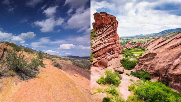
Best hikes in Breckenridge
Some of the best places to hike in Breckenridge, Colorado, range from a mining trail to a fourteener south of town. In December and January, average highs around nearby Dillon stay below freezing.
Sallie Barber Mine Trail
For easy hikes near Breckenridge, an option is Sallie Barber Mine Trail, an old mining road that climbs gently to a mine site above town. The Sallie Barber was a silver mine that kept operating during World War II, pulling lead and zinc after gold mining was shut down as “nonessential.”
- Distance and difficulty: The trail is about 0.9 miles with roughly 300 feet of elevation change, rated beginner-level.
- Best season: June through September, the only months when nearby Dillon averages highs above 65°F.
- Practical tip: The trail sees heavy use in winter, which leaves a packed-snow path.
Quandary Peak
Quandary Peak is south of Breckenridge, widely regarded as one of the easier, least technical fourteeners to summit. Still, none of the fourteeners are easy hikes, due to the high elevation and variable weather.
- Distance and difficulty: The trail is 3.1 miles one way, climbing more than 3,300 feet above timberline to over 14,000 feet.
- Best season: Summer, when Dillon averages highs between 69°F and 75°F, though July and August bring the most precipitation.
- Practical tip: In summer, access is only by parking reservation or shuttle from Breckenridge, followed by a ¼-mile walk to the trailhead.
Best places to hike in the Colorado mountains
Summer is generally the best time to hike in the mountains in Colorado, from Rocky Mountain National Park to the Maroon Bells.
Emerald Lake
Our most scenic hike in Colorado is the Emerald Lake Trail in Rocky Mountain National Park. Starting at the Bear Lake Trailhead, it passes Nymph and Dream Lakes before reaching Emerald Lake.
- Distance and difficulty: The trail is about 1.6 miles one way with roughly 700 feet of ascent, rated moderate.
- Best season: June through September with April and May being the Estes Park area’s wettest months.
- Practical tip: In season, the Bear Lake area requires a Timed Entry+ Bear Lake Road reservation.
Maroon Lake
The prettiest spot in Colorado is the Maroon Bells, reputed to be the most photographed mountains in the state. The peaks rise over 14,000 feet above Maroon Lake, and their maroon color comes from metamorphic sedimentary mudstone.
- Distance and difficulty: The Maroon Lake Scenic Trail is 1.3 miles with about 140 feet of elevation change.
- Best season: June through September, when Aspen averages highs of 67°F to 76°F.
- Practical tip: Reservations are required to reach the Maroon Bells Scenic Area, by shuttle or personal vehicle.
Sky Pond
Sky Pond is an alpine lake below jagged rock spires in Rocky Mountain National Park. The route follows the trail to the Loch, then steeply to Timberline Falls.
- Distance and difficulty: With more than 4 miles each way and about 1,800 feet of ascent, it’s rated difficult.
- Best season: Late summer into September, since the upper trail can be hard to follow in early summer.
- Practical tip: On the climb, stay just to the right of Timberline Falls, and expect to get wet at times.
Where is the “Stairway to Heaven” hike in Colorado?
“Stairway to Heaven” is a common search among Colorado hikers, but the name doesn’t belong to one official trail. Some link it to the Georgetown area, west of Denver. Local press, however, has dubbed the Manitou Incline Colorado’s “Stairway to Heaven,” so that’s our pick.
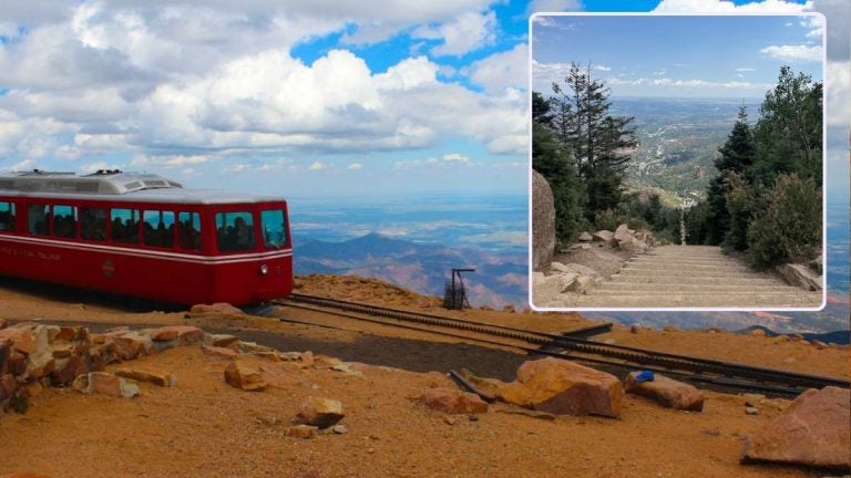
The Incline in Manitou Springs sits just west of Colorado Springs, a city that’s home to several of the best places to visit in Colorado. Its base sits near the start of the Barr Trail, across the street from the Cog Railroad.
The route climbs 2,768 steps, formed from railroad ties left after a 1990 rockslide closed the old cable car track. Officially rated Extreme, it requires a free reservation year-round.
Best places to hike in Colorado by season
Conditions at the best places to hike in Colorado change a lot by season and elevation.
| Season | Conditions | What to expect |
|---|---|---|
| Spring (March – May) | The wettest time of year is around Boulder, Estes Park, and Aspen. | Snowmelt feeds waterfalls like Maxwell Falls. Mount Bierstadt close for mud season. |
| Summer (June – August) | The warmest months across the state, with thunderstorms common above timberline. | Quandary Peak, Maroon Lake, and Rocky Mountain National Park’s Bear Lake area require reservations. |
| Fall (September – November) | Drier than summer around Evergreen, Lakewood, and Colorado Springs. September is one of Boulder’s wetter months. | September and October are prime for lower-elevation trails. |
| Winter (December – February) | The driest months around Estes Park and Colorado Spring. Highs near Dillon stay below freezing December to January. | Sallie Barber Mine stay packed with snow. Sky Pond carry avalanche danger. |
Note: Conditions are based off official weather records (1991–2020) showing the monthly averages. Data is from the weather station nearest each trail.
How to plan a hike in Colorado
Even the best places to hike in Colorado require cautious planning, since altitude, weather, and visitor rules can affect it.
- Acclimatize first: The risk of altitude illness starts around 8,000 feet, so spend two to three nights at about that level before heading higher.
- Start early: Trails above timberline carry a strong chance of afternoon thunderstorms with lightning, so begin in the early morning.
- Check reservations: Rocky Mountain National Park, the Manitou Incline, Quandary Peak, and the Maroon Bells all require reservations, at least in peak season.
- Plan for parking: Popular trailheads like Glacier Gorge fill up most days, so arrive early or have a backup trail in mind.
- Carry water: Trails like the Manitou Incline and Quandary Peak have no drinking water, and stream water should be treated before use.
- Use a trail app: COTREX, Colorado’s free official trail app, allows offline map downloads and important closure notices, with AllTrails also an option.
- Stay connected: An eSIM for Colorado helps check weather, trail conditions, and navigation, considering trail signal can be spotty.
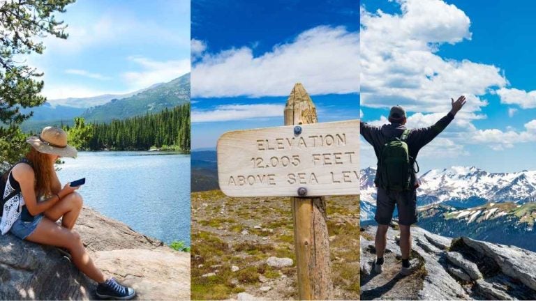
Stay connected on the trail with Holafly
Signal comes and goes in Colorado’s mountains, so download trail maps and permits before leaving town. When you do have coverage, data goes a long way with reservation changes, parking payments, and storm forecasts.
Visiting from abroad? Holafly eSIM gives you unlimited data across the States, so a US road trip needs just one eSIM. If you travel internationally more than twice a year, Holafly Plans replaces the per-trip eSIM. One plan covers 160+ destinations, renews monthly, and cancels any time, with no contracts.
If your plan ends before trip does, Always On gives you 1GB of backup data every 30 days as long as your eSIM stays installed.

FAQs about hiking in Colorado
These answers cover common questions about the best places to hike in Colorado.
Colorado hiking can suit beginners who pick short, gentle trails. Maroon Lake, the main paths at Garden of the Gods, and the Sallie Barber Mine Trail are officially described as flat, paved, or beginner-level.
Many trails don’t, but some popular ones do, such as Hanging Lake near Glenwood Springs and Mount Bierstadt.
Pack a rain shell and extra layers since mountain weather can change quickly. In icy conditions, traction devices like micro-spikes help on steep trails.
Some hidden gem hikes in Colorado are the Silver Dollar Lake Trail and the Abyss Lake Trail.


