Language
 Pacific Coast Highway road trip: Best stops, routes, and tips
A complete Pacific coast highway road trip guide covering the best stops, scenic routes, travel tips, and a 5-day itinerary.

There are road trips you take because you need a vacation, and then there are road trips you remember years later because the drive itself is the experience. The Pacific Coast Highway belongs firmly in the second category.
Stretching along the western coastline of the United States, this route has earned its reputation as one of the world’s most iconic drives for good reason. You spend hours winding along dramatic cliffside roads with the Pacific Ocean constantly appearing beside you, sometimes calm and blue, other times crashing violently against rocky beaches far below. One moment you are driving through misty coastal forests in Big Sur, and the next you are walking through relaxed beach towns where surfers, artists, and travelers all seem to move at a slower pace.
Unlike many famous road trips that feel rushed or overly touristy, the Pacific Coast Highway works best when travelers slow down. The route is full of places where you unexpectedly want to stop longer than planned — scenic overlooks, quiet beaches, seafood restaurants overlooking the ocean, coastal wineries, hidden hiking trails, and small towns that feel completely different from California’s larger cities.
How long is the road trip? Technically, you could drive major sections of the route in a couple of long days, but that completely misses the point of the experience. Most travelers spend between five and seven days driving the California portion comfortably, especially if they want enough time to stop, explore, and enjoy the scenery without constantly watching the clock.
The most popular version of the road trip runs between San Francisco and Los Angeles, although some travelers extend the journey north toward Seattle or south toward San Diego for a full West Coast experience.
Most experienced travelers also recommend driving north to south because the ocean stays directly beside your lane for much of the journey, making scenic pullovers easier and giving drivers uninterrupted coastal views throughout the trip.
The Pacific Coast Highway is not a road trip designed for speed. It is a drive built around scenery, flexibility, and those unexpected moments where you pull over simply because the view feels too beautiful to ignore.
Where does the Pacific Coast Highway start and end?
One thing that confuses many travelers is that the “Pacific Coast Highway” is not technically one single road stretching continuously along the West Coast.
Most people use the term to describe the scenic coastal drive running through much of California, especially along California State Route 1, commonly called Highway 1. However, parts of the broader West Coast route also involve US-101 and other connected highways depending on how far travelers want to extend the journey.
The classic Pacific Coast Highway itinerary refers to the California section between San Francisco and Los Angeles because this route includes many of the drive’s most famous coastal landscapes, including Big Sur, Monterey, Carmel-by-the-Sea, Malibu, and Santa Barbara.
This shorter California-only version works especially well for travelers with limited time because it balances manageable driving distances with some of the most scenic stretches of coastline in North America.
Some travelers choose a much larger West Coast road trip beginning in Seattle and ending in San Diego. This extended version includes parts of Washington, Oregon, and nearly the entire California coastline.
The longer version adds:
- Rocky northern coastlines.
- Forested highways.
- Additional national parks.
- Oregon’s dramatic cliffs and beaches.
- Washington’s cooler coastal scenery.
However, it also requires significantly more time. Most travelers need at least 10 to 14 days to complete the full West Coast route comfortably without rushing.
For first-time visitors, the San Francisco to Los Angeles route remains the best introduction because it combines coastal scenery, famous landmarks, manageable driving times, and strong tourism infrastructure all within one realistic itinerary.
Should you drive north to south or south to north?
Travelers debate this constantly before planning the trip, but most experienced Pacific Coast Highway drivers strongly recommend going north to south.
The main reason is surprisingly simple: The ocean stays directly beside your driving lane for much of the route.
When driving southbound, it becomes much easier to pull into scenic viewpoints, coastal parking areas, beaches, and roadside overlooks without constantly crossing traffic. Drivers also enjoy clearer, uninterrupted ocean views throughout the journey.
Driving northbound still offers beautiful scenery, but many pullouts end up positioned awkwardly across traffic, which is frustrating during busy travel seasons.
Weather also plays an important role when choosing travel direction and timing.
Northern California’s coastline, particularly around Big Sur and Monterey, experience frequent fog during late spring and early summer. Travelers visiting between May and July do encounter cool mornings and limited visibility along some coastal stretches.
September and October are considered ideal months because temperatures remain pleasant while fog becomes less intense.
Wildfire season is another factor travelers should monitor carefully, particularly during late summer and early autumn. California wildfires occasionally cause temporary road closures, detours, or air quality issues along parts of the route.
Checking current road conditions before departure is extremely important because landslides and weather-related closures occasionally affect Highway 1, especially near Big Sur.
Best Pacific Coast Highway itinerary (5–7 days)
One of the best things about this road trip is that the journey never feels repetitive. Each day brings completely different landscapes, towns, and driving experiences, even though you are technically following the same coastline south.
Day 1: San Francisco to Monterey
The road trip begins in San Francisco, one of California’s most recognizable cities and the perfect starting point for a coastal drive.
After leaving the city, many travelers stop first in Half Moon Bay, a relaxed coastal town known for dramatic ocean cliffs, beaches, and seafood restaurants. This stretch already introduces the slower rhythm that defines the rest of the journey.
Further south, Santa Cruz adds a very different atmosphere with surf culture, beach boardwalks, cafés, and coastal energy that feels youthful and laid-back.
By afternoon, travelers usually continue toward Monterey and nearby Carmel-by-the-Sea.
Monterey feels historic and maritime, especially around Cannery Row and the waterfront, while Carmel offers art galleries, boutique hotels, quiet streets, and one of the most charming coastal atmospheres anywhere in California.
Day 2: Monterey to Big Sur
This is the day many travelers look forward to most because the drive through Big Sur contains some of the Pacific Coast Highway’s most famous scenery.
The road is narrower and more dramatic as cliffs rise sharply beside the ocean. Nearly every few miles, another viewpoint appears where travelers end up stopping for photos even if they originally planned not to.
One of the most photographed landmarks along the route is the Bixby Creek Bridge, which curves dramatically across coastal cliffs and has become almost symbolic of the Pacific Coast Highway itself.
This section of the drive feels less urban and far more natural. Travelers pass forests, rocky coastlines, waterfalls, hiking trails, and secluded beaches where the Pacific Ocean feels enormous and wild.
Fuel stations are more limited here, which is why filling up before entering Big Sur is important.
Mobile coverage also weakens significantly throughout parts of this region, so downloading offline maps before leaving Monterey helps avoid navigation issues.
Most travelers spend the night somewhere within or near Big Sur because rushing through this section defeats much of the experience.
Day 3: Big Sur to San Luis Obispo
Leaving Big Sur, the scenery gradually changes from rugged cliffs to softer coastal landscapes and historic towns.
One major stop along this route is Hearst Castle, the enormous hilltop estate built by newspaper magnate William Randolph Hearst. Even travelers who normally skip guided tours often find the architecture, ocean views, and history fascinating.
Nearby Cambria offers a quieter coastal atmosphere with art galleries, cafés, and small inns overlooking the shoreline.
Further south, Morro Bay becomes recognizable immediately because of Morro Rock, the giant volcanic formation rising beside the harbor.
By evening, most travelers reach San Luis Obispo, often called SLO by locals. The city blends beach-town energy with wine country surroundings and a relaxed college-town atmosphere.
Day 4: San Luis Obispo to Santa Barbara
This portion of the drive is warmer, sunnier, and more Mediterranean compared to the dramatic cliffs farther north.
Travelers often stop in Pismo Beach for coastal walks, seafood, or beach views before continuing south.
One particularly interesting stop inland is Solvang, a small Danish-inspired town known for windmills, European-style bakeries, and wine tasting rooms.
The surrounding Santa Ynez Valley also contains many coastal wineries, making this part of the route especially popular among travelers interested in food and wine experiences.
By evening, travelers reach Santa Barbara, one of the most elegant coastal cities in California.
Palm-lined streets, Spanish-style architecture, oceanfront restaurants, and mountain views give Santa Barbara a completely different atmosphere from the northern sections of the trip.
Day 5: Santa Barbara to Los Angeles
The final driving day gradually shifts from relaxed coastal towns into the enormous urban energy of Southern California.
Before reaching Los Angeles, most travelers stop in Malibu, famous for oceanfront homes, surfing beaches, and scenic coastal roads.
Further south, Santa Monica offers the classic Southern California beach atmosphere with its famous pier, beachfront bike paths, and lively waterfront.
Many travelers finish the road trip at Venice Beach, where street performers, skateboarders, musicians, and beachgoers create one final reminder that this road trip is just as much about atmosphere as scenery.
What to know before driving the Pacific Coast Highway
The Pacific Coast Highway looks effortless in photos, but driving it requires more preparation than many travelers initially expect.
Road closures happen fairly regularly, particularly near Big Sur, where landslides occasionally damage sections of Highway 1. Checking California Department of Transportation road updates before departure is extremely important because closures sometimes force long detours.
Fuel stations also become surprisingly limited along certain coastal stretches, especially through Big Sur. Travelers should refill frequently instead of waiting until the tank becomes low.
The roads themselves are beautiful but often extremely curvy. Drivers unused to winding coastal highways should expect slower driving times than navigation apps sometimes estimate.
Parking is also difficult during summer weekends in popular areas such as Monterey, Carmel, Malibu, and Santa Barbara.
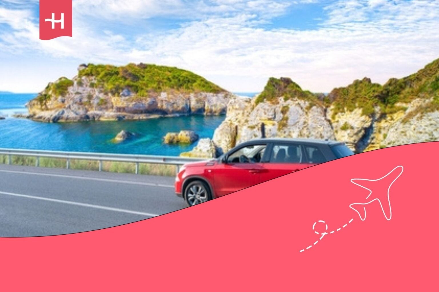
Rental cars work perfectly for this road trip, although travelers should inspect vehicle policies carefully because some rental companies place restrictions on certain remote roads or require additional insurance coverage.
Mobile coverage disappears in parts of Big Sur and other isolated sections of the route, which makes offline maps extremely useful throughout the trip.
What to pack for a Pacific Coast Highway road trip
California’s coastline changes temperature constantly throughout the day, even during summer.
Warm afternoons often turn into cool, foggy evenings surprisingly quickly, especially in Northern California. Packing layers is essential because travelers may experience sunshine, coastal wind, and chilly fog all within the same day.
Some of the most useful items for this road trip include:
-
- Comfortable layers and jackets.
-
- Sunglasses.
-
- Portable chargers.
-
- Offline maps.
-
- Snacks and water.
-
- Camera equipment.
-
- Comfortable walking shoes.
-
- Reusable water bottles.
Reliable connectivity also matters more than many travelers expect because navigation, hotel reservations, roadside assistance, and weather updates all depend heavily on mobile data during the trip.
Travelers crossing borders before arriving in the US or continuing into multiple countries afterward often prepare mobile connectivity in advance using eSIM services to avoid roaming problems and unreliable public Wi-Fi networks.

Why the Pacific Coast Highway feels different from other road trips
Some road trips revolve around reaching famous landmarks as quickly as possible. The Pacific Coast Highway works differently because the drive itself is the highlight.
You remember the unexpected roadside viewpoints, the quiet beach towns, the dramatic cliffs near Big Sur, the fog rolling over the coastline in the early morning, and the moments where you stop the car simply because the scenery feels impossible to ignore.
The route rewards travelers who leave room for spontaneity. Some of the best moments happen during unplanned detours, extra coffee stops, coastal walks, or scenic overlooks that were never part of the original itinerary.
Driving the Pacific Coast Highway slowly is always the better decision because this journey was never really designed to be rushed.
Plans that may interest you


English Copywriter at Holafly, I'm committed to sharing tips that will make your travel experiences memorable. Over the years as a writer and strategist, I've managed teams across multiple industries - SaaS, tech, real estate, and personal brands. I wrote my first book as a child and have been writing ever since, cooking and reading are a few ways I explore my world.