Language
 Best road trip apps for navigation, planning, and safety
A complete guide to the best road trip apps for navigation, planning, safety, fuel, parking, and connectivity during road travel.

Road trips have changed completely over the last decade. Travelers still chase the same feeling of freedom that road travel has always offered — long highways, spontaneous detours, scenic viewpoints, late-night food stops, and the excitement of discovering unfamiliar places, but the way people actually manage those trips now depend heavily on mobile apps.
Modern road trips run on digital tools almost as much as they run on fuel.
Drivers use apps to avoid traffic jams in major cities, locate affordable gas stations in remote areas, reserve hotels at the last minute, download offline maps before losing signal in the mountains, split travel expenses with friends, and stay connected while crossing international borders. Even simple things like finding parking in crowded downtown areas or checking whether a rest stop is still open happen through apps now.
The difference between a smooth road trip and a stressful one comes down to preparation, and a huge part of that preparation involves downloading the right apps before leaving home.
This becomes even more important during international road trips. Travelers driving across Europe, for example, often cross several countries in a single week. That means dealing with different languages, toll systems, mobile networks, road signs, parking regulations, and fuel prices. Without reliable navigation, internet access, and planning tools, simple travel tasks become frustrating surprisingly quickly.
At the same time, not every app solves the same problem. Some are designed specifically for navigation and real-time traffic updates, while others focus on route organization, travel budgeting, campsite discovery, parking availability, or fuel tracking.
Understanding which apps actually improve the road trip experience helps travelers avoid downloading dozens of unnecessary tools that only clutter their phones without providing real value.
The best road trip apps usually share a few important qualities:
- They work reliably in unfamiliar environments.
- They save time during long drives.
- They reduce stress during unexpected situations.
- They improve safety and convenience.
- They continue functioning even when internet access becomes unreliable.
A traveler driving through remote mountain roads in Norway needs very different digital tools compared to someone navigating crowded city traffic in Los Angeles. This is why understanding how each app works in real travel situations matters far more than simply downloading the most popular one.

Best navigation apps for road trips
Navigation apps are the foundation of modern road travel because almost every other part of the journey depends on knowing where you are, how long the drive will take, where delays exist, and which alternate routes are available.
The best navigation apps do much more than provide directions from one place to another. They now function as real-time travel assistants capable of warning drivers about accidents, suggesting faster routes, locating nearby services, and helping travelers adapt instantly when road conditions change.
Different apps perform better in different environments, which is why experienced road trippers often keep more than one navigation app installed.
Google Maps
Google Maps remains the most widely used navigation platform globally because it combines mapping, route optimization, live traffic updates, business directories, and travel recommendations into one system that feels intuitive for most users.
One of the biggest reasons travelers rely so heavily on Google Maps is the sheer amount of real-time information it provides during a drive. The app constantly analyzes traffic flow, road closures, accidents, and construction work before suggesting alternate routes automatically.
This is incredibly useful in large urban areas where traffic patterns change minute by minute. A driver entering New York City during rush hour may save a significant amount of time simply because Google Maps reroutes traffic around congestion zones automatically.
Google Maps also integrates nearby services directly into the driving experience. Travelers can search for:
- Gas stations.
- Hotels.
- Restaurants.
- Grocery stores.
- EV charging stations.
- Pharmacies.
- ATMs.
- Car repair shops.
This is especially useful during long-distance road trips where drivers frequently need quick access to services without spending time searching manually online.
Another major advantage is offline map support. Before entering remote areas, travelers can download entire regions directly onto their devices and continue navigating without mobile signal coverage.
This feature is extremely important during:
- Mountain drives.
- Desert highways.
- National park routes.
- International border crossings.
- Rural road trips.
Many travelers only realize how important offline maps are after suddenly losing signal in isolated areas where navigation disappears completely.
Google Maps is free to use, which makes it accessible for nearly every traveler regardless of budget. However, the app performs best when connected to mobile data because real-time traffic updates, hazard alerts, and route recalculations depend heavily on live internet connectivity
Waze
Waze approaches navigation differently by relying heavily on community-generated road information.
Instead of depending only on static mapping systems, Waze collects live reports from drivers actively using the app. Users report accidents, traffic jams, speed cameras, police activity, debris on roads, stalled vehicles, flooded streets, and other driving hazards in real time.
This creates a constantly updating road network powered directly by drivers themselves.
For heavily populated regions, this system works extremely well because thousands of active users continuously feed fresh information into the platform. Drivers navigating crowded highways near cities such as Chicago or London often prefer Waze specifically because of how aggressively it reroutes traffic around delays.
Waze also provides:
- Speed limit warnings.
- Toll road alerts.
- Hazard notifications.
- Police presence alerts.
- Fuel station price comparisons.
- Voice-guided navigation.
Many commuters and long-distance drivers appreciate how quickly Waze reacts to changing road conditions compared to more traditional navigation systems.
The app is completely free.
Its biggest weakness is in remote regions where fewer users actively contribute updates. Community reporting is less effective when there are not enough nearby drivers sharing information.
For isolated road trips through deserts, forests, or mountain regions, travelers often combine Waze with offline-capable navigation apps.
MAPS.ME
MAPS.ME has built a strong reputation among travelers because it focuses heavily on offline navigation reliability.
Unlike apps that rely heavily on continuous internet access, MAPS.ME allows travelers to download entire countries or regions before the trip starts and navigate completely offline afterward.
For international road trips, this is incredibly valuable because travelers avoid expensive roaming charges while maintaining reliable navigation access.
The app performs particularly well in:
- Rural regions.
- National parks.
- Hiking areas.
- Cross-border routes.
- Remote highways.
- Outdoor travel environments.
MAPS.ME also includes detailed points of interest such as:
- Hotels.
- Restaurants.
- Hiking trails.
- Scenic viewpoints.
- Fuel stations.
- Tourist attractions.
Travelers driving through areas with weak infrastructure often rely on MAPS.ME because it continues functioning even when mobile networks disappear entirely.
The free version satisfies most travel needs, while premium features remove ads and provide additional customization tools.
Best apps for planning routes
Navigation apps help drivers move efficiently during the trip itself, but route-planning apps focus more heavily on organizing the overall journey before the road trip even begins.
This is extremely important during multi-day trips where travelers plan to visit several destinations, national parks, scenic routes, or multiple countries.
Good route-planning apps help travelers visualize the entire journey instead of simply driving from one location to another.
Roadtrippers
Roadtrippers was designed specifically for long-distance driving experiences and scenic road travel.
Instead of focusing only on efficiency, the app encourages travelers to discover interesting stops along the route itself. This changes the mentality of road travel from “getting somewhere quickly” to actually enjoying the journey.
Users can discover:
- Scenic viewpoints.
- Roadside attractions.
- National parks.
- Hiking trails.
- Small towns.
- Museums.
- Restaurants.
- Campgrounds.
- Hidden travel spots.
For travelers driving across the United States or Canada, where distances between destinations can be enormous, this helps transform long drives into much richer travel experiences.
The app also estimates:
- Fuel expenses.
- Driving times.
- Overnight stops.
- Total mileage.
- Travel duration.
Roadtrippers offer both free and premium versions. The premium subscription unlocks larger route planning limits, offline support, and more advanced trip customization.
Sygic Travel
Sygic Travel focuses heavily on structured travel planning and itinerary organization.
This app works particularly well for travelers exploring multiple cities across Europe because it helps organize attractions, hotels, transportation, and sightseeing activities into one connected schedule.
Travelers can build detailed day-by-day plans that include:
- Driving routes.
- Attraction tickets.
- Hotel reservations.
- Walking distances.
- Public transportation options.
- Restaurant locations.
Offline functionality is especially useful for international travelers who may not always have reliable internet access while moving between countries.
The app offers free functionality alongside premium upgrades that unlock advanced offline tools and additional planning features.
Wanderlog
Wanderlog combines collaborative planning with itinerary management, making it useful for group road trips.
Many group trips are stressful because reservations, budgets, destinations, and schedules exist across several phones, emails, and messaging apps simultaneously. Wanderlog centralizes everything into one shared travel workspace.
Travelers can organize:
- Hotels.
- Restaurants.
- Attractions.
- Reservations.
- Daily schedules.
- Budgets.
- Driving routes.
The app automatically maps all planned stops visually, helping users understand how practical their route actually is before leaving.
Group members can also collaborate in real time, which helps everyone stay updated during longer trips involving several people.
Best apps for finding gas, parking, and rest stops
Road trips are much more exhausting when travelers constantly struggle to locate fuel stations, safe parking, rest areas, or overnight stopping points.
These practical travel apps solve many of the small logistical problems that slowly create stress during long drives.
GasBuddy
Fuel expenses are one of the largest costs during long-distance road trips, especially in countries where gas prices vary significantly between cities or regions.
GasBuddy helps travelers compare nearby fuel prices in real time using community-reported updates from other drivers.
This allows travelers to identify:
- The cheapest nearby fuel stations.
- Fuel price trends.
- Stations along the planned route.
- Diesel availability.
- EV charging stations in some regions.
During long drives across the United States, where fuel price differs between states, the savings add up quickly. The app is free and particularly useful for budget-conscious travelers covering long distances.
Park4Night
Park4Night has become popular among van travelers, campers, RV travelers, and long-term road trippers.
The app helps users locate:
- Overnight parking.
- Campsites.
- RV-friendly locations.
- Scenic rest areas.
- Public facilities.
- Quiet sleeping spots.
Community-generated reviews provide detailed information about safety, cleanliness, noise levels, accessibility, and nearby services.
This makes the app especially valuable during flexible road trips where travelers do not always book accommodations in advance.
iExit
iExit focuses specifically on highway travel by showing services available at upcoming exits. Instead of waiting until fuel becomes critically low or hunger becomes a problem, drivers can prepare ahead by seeing what services are approaching along the highway.
The app displays:
- Gas stations.
- Restaurants.
- Hotels.
- Rest areas.
- EV charging stations.
- Convenience stores.
This is particularly helpful during nighttime driving or unfamiliar interstate routes where exits appear quickly and missing one can add significant delays.
Best apps for remote workers and digital nomads on the road
Road trips are no longer limited to vacations alone. Many travelers now work remotely while traveling, which creates a completely different set of priorities involving internet access, expense management, and reliable communication tools.
Splitwise
Managing shared travel expenses is surprisingly complicated during group road trips.
Fuel purchases, hotel costs, toll payments, parking fees, restaurant bills, and groceries quickly create confusion over who paid for what.
Splitwise simplifies this process by tracking shared expenses automatically. Users log payments into the app, and the platform calculates balances between travelers.
This prevents awkward money conversations and eliminates the need for constant manual calculations throughout the trip.
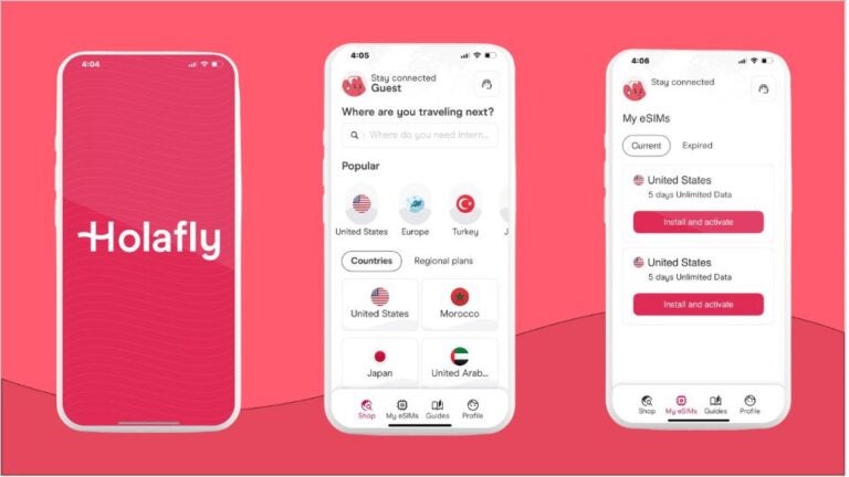
Holafly eSIM
Reliable internet access has become one of the most important parts of modern road travel because travelers depend heavily on navigation apps, online bookings, messaging platforms, and emergency communication throughout the trip.
International road trips create additional challenges because roaming charges become expensive quickly once travelers cross borders.
This is why many travelers now rely on eSIM services such as (Holafly) for mobile connectivity.
An eSIM allows travelers to activate mobile data digitally without replacing physical SIM cards, making it much easier to stay connected across several countries during a single road trip.
For travelers driving across Europe, this is especially convenient because navigation, hotel reservations, translation apps, and emergency services continue functioning smoothly without depending entirely on public Wi-Fi networks.
Strong connectivity is even more important in remote areas where travelers rely heavily on mobile data for:
- GPS navigation.
- Weather updates.
- Emergency communication.
- Road condition alerts.
- Hotel bookings.
- Translation apps.

Preparing your apps before the trip starts makes a huge difference
One of the biggest mistakes travelers make is assuming they can download everything during the trip itself.
Road trips often involve remote highways, mountain roads, national parks, border crossings, and rural regions where mobile signal is unreliable or disappears completely.
Preparing apps before departure helps travelers avoid unnecessary stress later. Experienced road trippers usually:
- Download offline maps in advance
- Save hotel confirmations locally
- Activate eSIM plans before crossing borders
- Store emergency contact information
- Organize routes ahead of time
- Bookmark fuel stations and overnight stops
The best road trip apps do not remove the unpredictability that makes road travel exciting in the first place. Instead, they reduce avoidable stress and help travelers focus more on the actual experience of the journey.
When navigation works properly, fuel stops become easier to manage, parking is less frustrating, and internet access remains stable, travelers spend less time solving preventable problems and far more time enjoying the freedom that road trips are supposed to offer.
Plans that may interest you

English Copywriter at Holafly, I'm committed to sharing tips that will make your travel experiences memorable. Over the years as a writer and strategist, I've managed teams across multiple industries - SaaS, tech, real estate, and personal brands. I wrote my first book as a child and have been writing ever since, cooking and reading are a few ways I explore my world.